List of Islands in Marlborough
By: Christopher Cookson
Last Modified: 19-7-2020 22:44
© Christopher Cookson License this image
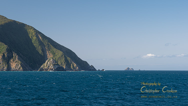
Marlborough has a large number of islands, all found within, or offshore of the Marlborough Sounds. The largest islands cover thousands of hectares, while the smallest are only a few hundred square metres. Some of Marlborough's islands have areas of private ownership, while several are nature reserves with restricted access. A few have campsites, and the largest, Rangitoto ki te Tonga/D'Urville Island has roads.
List of Marlborough islands by land area1
Rangitoto ki te Tonga / D'urville Island
Area: 163Km sq (16,300Ha)
Highest Point: 729m
Public Access: Yes
Status: Mixed private/public ownership
Population: Approximately 50
Rangitoto ki te Tonga / D'Urville Island is the eighth largest island in New Zealand, and includes a mix of private farmland and public conservation land. It is located in the north west of the Marlborough Sounds.
Arapaoa Island
Area: 75Km sq (7,500Ha)
Highest Point: 559m
Public Access: Yes
Status: Mixed private/public ownership
Population: Approximately 50
Arapaoa Island (also known as Arapawa Island), is the second largest island in the Marlborough Sounds, and thirteenth largest in Aotearoa / New Zealand. The island includes private land and DOC administered conservation reserve. A rare breed of goats with a unique genetic profile is established on the island. It forms part of the southern coast of Queen Charlotte Sound and the northern coastline of Tory Channel. Arapaoa is of special significance to Te Atiawa.
Te Paruparu / Forsyth Island
Area: 706.88Ha
Highest Point: 356m
Public Access: No
Status: Private
Te Paruparu / Forsyth Island is one of a handful of privately owned islands in New Zealand.
Oruwairua / Blumine Island
Area: 376.73 hectares
Highest Point 298m
Public Access: Yes
Status: Scenic Reserve
Population: Uninhabited
Blumine Island is a predator free island in Queen Charlotte Sound. A number of endangered bird species are found on the island. The island was used for sheep farming in the 19th Century, and during World War II a concrete gun emplacement was built. A basic campsite and a walking track are present on the island. There are no jetties or moorings.
Te Hoire / Maud Island
Area: 309.43 hectares
Highest Point: 368m
Public Access: No
Status: Scientific Reserve
Te Hoire / Maud Island is the largest island in Pelorus Sound and an important predator free sanctuary for a variety of endangered species including birds, reptiles, and amphibians. The island was important to Māori for food cultivation, and later much of it was cleared for sheep farming in the 19th Century. During World War II various military installations were established on the island. In the 1970s, the island was first used as a wildlife refuge, with eventually the whole island passing to Crown ownership. Visits to the island are strictly controlled, and must be pre-approved with DOC staff.
Takapourewa / Stephens Island
Area: 148.17 Hectares
Highest Point: 283m
Public Access: No
Status: Nature Reserve
Takapourewa / Stephens Island is the northernmost point in Marlborough (roughly the same latitude as Levin), and the main home of New Zealand's endemic tuatara. It has a lighthouse, and lighthouse keepers' cottages, now used by DOC, as the lighthouse has been automated since 1989.
Te Kakaho Island / Nukuwaiata (Chetwode Islands)
Area: 280 hectares
Highest Point: 247m
Status: Nature Reserve
Public Access: No
The Chetwode Islands are two predator free islands at the northern entrance to Pelorus Sound.
Long Island
Area 116.7 hectares
Highest Point: 152m
Public Access: Yes
Status: Marine Reserve
Long Island is a predator free island in outer Queen Charlotte Sound, with a marine reserve extending to 463m offshore, where any form of fishing or disturbance of the marine environment is prohibited. There are no jetties, however landing is possible at several points. During World War II, a system to detect enemy submarines was installed.
Matapara / Pickersgill Island
Area: 96.32 hectares
Highest Point: 186m
Public Access:
Status: Scenic Reserve
Matapara / Pickersgill Island is an island in Queen Charlotte Sound about a hundred metres offshore of Arapaoa Island. DOC attempts to main it predator free, however reinfestation of rats has occurred probably due to its proximity to Arapaoa Island.
Tinui Island
Area: 89.03 hectares
Highest Point: 190m
Public Access: No
Status: Private
Tinui Island is part of the Rangitoto Island chain and is owned by families from Ngāti Koata.
Wakaterepapanui Island
Area: 60.7 hectares
Highest Point: 225m
Status: Recreation Reserve
Wakaterepapanui is part of the Rangitoto Island chain off the northeast coast of Rangitoto ki te Tonga / D'Urville Island. It is administered by DOC.
Motuara Island
Area: 48.7 hectares
Highest Point: 128m
Public Access: Yes
Status: Scenic Reserve
Motuara Island is a predator free island in Queen Charlotte Sound. The island is home to a variety of endangered bird species. The island was significant to Māori, and was also where Captain Cook declared British sovereignty over New Zealand. The island was burnt and farmed in the early 20th Century, however is now covered in regenerating native vegetation. A jetty is available for boat access.
Puangiangi Island
Area: 38.45 hectares
Highest Point: 150m
Public Access: No
Status: Private
Puangiangi Island was owned by Ross Webber from 1957 to 2004, who was its sole inhabitant. During Webber's ownership, the island was partially cleared and run as a sheep farm. It is now owned by a charitable trust, Fauna Recovery New Zealand which aims to run the island as a nature reserve.
Kuru Pongi / Trio Islands
Area: 32.4 hectares
Highest Point: 86m
Status: Nature Reserve
Public Access: No
Kuru Pongi / Trio Islands are several small islands and reefs around the central island of Kuru Pongi, located between the Chetwode Islands and Rangitoto ki te Tonga / D'Urville Island in the outer Marlborough Sounds. They are classified as a wildlife sanctuary, and access is strictly prohibited, however their Māori owners may make customary collection of titi or muttonbird during a limited season.
Titi Island
Area: 32.38 hectares
Highest Point: 99m
Status: Nature Reserve
Titi Island is a predator free island in the northern Marlborough Sounds. It is home to a number of seabirds, and in addition, tuatara and two wētā species were introduced in the mid to late 1990s, which added to the invertebrate and reptile species already found on the island. In 1856 Ngāti Kuia sold Titi Island to the Crown, however continued customary harvesting of titi (muttonbirds) until 1909 when the island was designated as a flora and fauna reserve by the Crown which then denied customary access. In 1918, customary access resumed.
Tawhitinui Island / Tarakaipā Island
Area: 54.4 hectares (combined)
Highest Point: 122m (Tarakaipā Island)
Status: Scenic Reserve
Public Access: Yes
Tawhitinui and Tarakaipā Island are located in Tennyson Inlet. The islands are covered in native forest, and although possum free, have ongoing problems with rats and wasps. Ongoing pest control is undertaken by the Department of Conservation in collaboration with a trust established with the aim of ensuring the islands remain as predator free as possible. Ngāti Kuia have ownership on Tarakaipā Island as part of their treaty settlement, and Ngāti Apa also have cultural association recognised.
Otuhaereroa Island
Area: 19.4 hectares
Highest Point: 100m
Otuhaereroa Island is a small, bush clad island in Croisilles Harbour in the Marlborough Sounds. The island was included in the Ngāti Kōata Treaty of Waitangi Settlement.
Motu Ngārara / Allports Island
Area: 17.4 hectares
Highest Point: 79m
Status: Scenic Reserve
Public Access: Yes
Motu Ngārara / Allports Island is an island in Tōtaranui / Queen Charlotte Sound opposide Waikawa Bay, named after Thomas Allport who leased and farmed the island in the late 19th Century. Subsequent to the death of Allport, the Department of Agriculture used the island to breed Angora goats until the island became a scenic reserve in 1927. The island is covered in regenerating native bush. The Māori name means lizard island. Penguins use the island as a breeding ground, and robins and kiwi are found on the island. Predator control has been undertaken by DOC to reduce rats, mice and possums, however there have been problems with hunters illegally releasing pigs on the island. No moorings are available.
Motuanauru Island
Area: 8.88 hectares
Highest Point: 113m
Motuanauru Island is a small, bush clad island in Croisilles Harbour in the Marlborough Sounds. The island was included in the Ngāti Kōata Treaty of Waitangi Settlement.
Ngāwhatu-kai-ponu / The Brothers
Area: 4.07 / 8.00 hectares
Highest Point: 66m
Status: Nature Reserve
Public Access: No
The Brothers are two small rocky islands in Cook Strait, and mark the easternmost extent of Marlborough. The Māori name Ngāwhatu-kai-ponu refers to the eyeballs of the giant octopus the Polynesian explorer Kupe battled according to tradition. The northernmost of the two islands has a lighthouse that was initially constructed in 1877 and manned until 1990 when it was fully automated. The Brothers lighthouse was the last manned lighthouse in New Zealand. The islands are managed by DOC, and public access is not permitted. Several endangered plant species are found on the islands, along with tuatara. In spite of their isolation, several pest plant species have established on the islands, and DOC runs an eradication programme.
Amerikiwhati Island, Motungarara Island, Kokomahua Islands
Area: 20.54 hectares (total)
Highest Point: 40m (Kokomahua Islands)
This group of small islands are found off the north coast of Arapaoa Island in Tōtaranui / Queen Charlotte Sound. Te Ātiawa are recognised as kaitiaki of Amerikiwhati Island.
Ouokaha Island
Area: 4.05 hectares
Ouokaha Island is a small island in Crail Bay, Pelorus Sound. The island supports a significant marine ecosystem, and was recommended to be classified as a significant marine site in a study carried out between 2017 and 2018 by Davidson Environmental for Marlborough District Council. The island is covered in native vegetation, however there is evidence of urupā on the island.
Puotewheke / Scuffle Island, Tu Araiawa / Fin Island, Tapuareroutuutu Island, Te Kurukuru / Stewart Island, Anatakupu Island, Moutiti / Victory Island, Kaitaore / Nelsons Monument
Area: 16.9 hectares (total)
Highest Point: 112m (Moutiti / Victory Island)
These islands are a group of small islands scattered around Rangitoto ki te Tonga / D'Urville Island, grouped together under the same land title. Moutiti / Victory Island is the largest of the group.
Karaka / Hamilton Island
Area: 2.02 hectares
Status: Recreation Reserve
Karaka / Hamilton Island is a small island in Admiralty Bay in the north west of the Marlborough Sounds. It was privately owned from 1865 to 1095 and is named for its former owner, Thomas Hamilton. The island is steep, however is covered in native vegetation including karaka trees from which its Māori name is derived.
Horahora Kakahu Island
Area: 2.35 hectares
Status: Historic Reserve
Horahora Kakahu Island is a historic reserve and only island in Port Underwood, and was the location of the main South Island signing of the Treaty of Waitangi.
Bird Island
Area: 0.85 hectares
Bird Island is a small, elongated uninhabited rocky island in Forsyth Bay in the northern Marlborough Sounds. It has a cover of native vegetation and is used as a nesting ground by several bird species with particular significance for reef heron.
Mabel Island
Area: 0.8 hectares
Status: Scenic Reserve
Mabel Island is a small, bush covered island in Picton Harbour. It is named after the daughter of Governor Thomas Gore Browne.
Moioio Island
Area: 0.8 hectares
Status: Scenic Reserve
Public Access: No
Moioio Island is a small island in Kura te au / Tory Channel at the mouth of Erie Bay. It was part of the Te Ātiawa o te Waka-a-Māui treaty settlement.
Clark Island
Area: 0.8 hectares
Highest Point: 11m
Clark Island is a small island in Keneperu Sound near Goulter Bay.
Glasgow Island
Glasgow Island is a small island in Glasgow Bay in eastern Marlborough, exposed to Cook Strait.
Hautai Island, Le Brun Island
Two small islands off the southernmost end of Rangitoto ki te Tonga / D'Urville Island.
Hāpuka Island
Hāpuka Island is a small, elongaged, rocky island immediately to the south of Ōkārewa Point on Rangitoto ki te Tonga / D'Urville Island. The island has some native vegetation cover on its highest points.
1.Where possible, land area information was accessed from Marlborough District Council Smart Maps property maps (external link). In some cases, data for several islands is grouped together under one property file, making it impossible to identify the land areas of individual islands in the group. In this case, the groups of islands were listed in order based on the average size of islands based on the total land area given. In some cases property data was not listed, and in these cases islands were compared visually with similar sized islands to determine ranking.
2.Even if public access is indicated, be aware that this status may change due to weather conditions, pest control, rāhui etc, and if in doubt check with either Marlborough District Council, DOC or local iwi.
Cite this page
Cookson, C. (2020). List of Islands in Marlborough. Retrieved May, 9, 2024, from https://www.marlboroughonline.co.nz/marlborough/information/geography/coastal-areas/islands-in-marlborough