Te Kakaho Island / Nukuwaiata (Chetwode Islands)
Last Modified: 14-5-2020 10:36
By: Christopher Cookson
© Christopher Cookson License this image
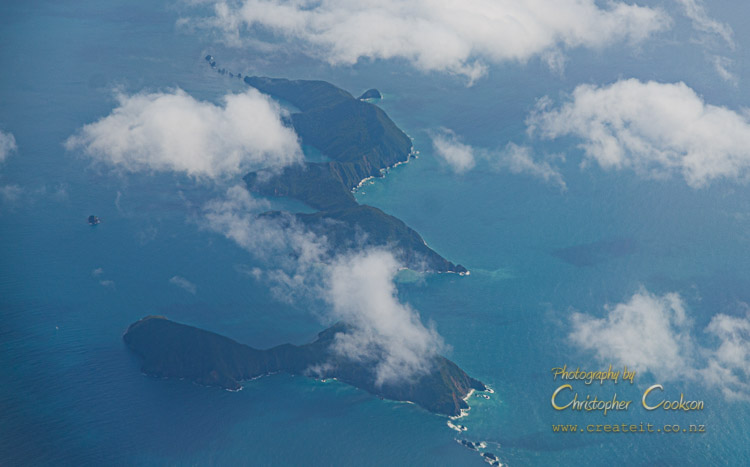
Te Kakaho Island / Nukuwaiata or the Chetwode Islands are two predator free islands at the northern entrance to Pelorus Sound in northern Marlborough. The island group is named after Lieutenant Chetwode, commander of the Pelorus, who was the first European to explore the area. Traditionally, the islands were an important site for harvesting titi (muttonbirds) for Ngāti Kuia. In 1856, the Crown acquired title to the islands in a disputed sale, with farming occuring for a time until in 1904 Nukuwaiata became a nature reserve. A variety of native vegetation is found on the islands including mature mānuka, five finger, ake ake, mahoe, and akiraho. Rats and introduced weka were eliminated from the islands by DOC in 1993, allowing native reptiles to flourish, along with a range of bird species including breeding populations of toutuowai (South Island robin), kākāriki, mōhua and kārearea / NZ Falcon. Various invertebrates inclucing tree wētā are also present. In 2004, 40 endangered Hamilton's frogs were moved from Stephens Island to Nukuwaiata Island.
As part of the Ngāti Kuia Deed of Settlement signed in October 2010, Ngāti Kuia are recognised as kaitiaki of the Chetwode Islands.
Area: 280 hectares
Highest Point: 247m
Status: Nature Reserve
Public Access: No
Web Links
Cite this page
Cookson, C. (2020). Te Kakaho Island / Nukuwaiata (Chetwode Islands). Retrieved April, 19, 2024, from https://www.marlboroughonline.co.nz/marlborough/information/geography/coastal-areas/chetwode-islands/