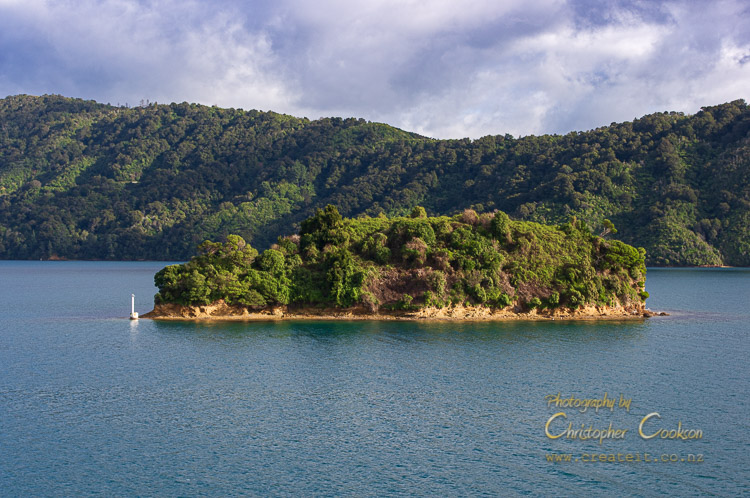
Tukurehu / Mabel Island
Last Modified: 15-4-2020 22:07
By: Christopher Cookson
© Christopher Cookson License this image
Tukurehu / Mabel Island is a small, bush covered rocky island in Picton Harbour. The Māori name signifies 'The island that appears out of the mist', while it was given its English name by Governor Thomas Gore Browne, who named it after his daughter. There is archaelogoical evidence of pre-European occupation of the island, while after colonisation, the island was farmed for a time before being declared a scenic reserve in 1927.. A native plant popular in cultivation for its flowers, Arthropodium cirratum, was known at one time as 'Mabel Island Lily', presumably because it was abundant on the island at some stage. According to Māori traditional ecological knowledge*, Tuatara were once present on the island.
As part of the Te Ātiawa Te Waka a Māui Deed of Settlement signed in December 2012, the iwi gained recognition as kaitiaki of the island.
A navigation light is located at the south end of the island.
In 2018, the launch, Carpe Diam ran aground on the island, resulting in a prosecution and fine.
Area: 0.8 hectares
Status: Scenic Reserve
*Ramstad, Kristina & Nelson, N & Paine, G & Beech, D & Paul, A & Paul, P & Allendorf, Fred & Daugherty, C. (2007). Species and Cultural Conservation in New Zealand: Maori Traditional Ecological Knowledge of Tuatara. Conservation biology : the journal of the Society for Conservation Biology. 21. 455-64. 10.1111/j.1523-1739.2006.00620.x.
Cite this page
Cookson, C. (2020). Tukurehu / Mabel Island. Retrieved April, 27, 2024, from https://www.marlboroughonline.co.nz/marlborough/information/geography/coastal-areas/tukurehu-mabel-island/