Camping in Marlborough
By: Christopher Cookson
Last Modified: 4-12-2020 12:23
© Christopher Cookson License this image
With typically fine weather, a low population, and plenty of wilderness areas, Marlborough offers plenty of opportunities to spend a night or more camping out under the stars. According to the Department of Conservation website, DOC manages over 200 campsites nationwide, and around 50 or a quarter of them are in Marlborough, a region with only one percent of New Zealand's population! For different people, camping can mean different things; for some it’s pitching a tent and living with just the basics, while for others it may involve a camper van with everything included, even quite literally the kitchen sink.
Not all campsites in Marlborough are suitable for all types of camping. Some in the Marlborough Sounds are accessible only by boat, while others though accessible by vehicle, certainly aren’t suitable for heavy camper vans, and some require a sturdy four wheel drive. For the purpose of this guide, I’ve selected campsites that should be accessible to the majority of travellers, regardless of how you’re travelling.
In Marlborough most campsites are managed by the Department of Conservation (DOC). These vary greatly from fully serviced sites with kitchen facilities, hot showers, and even shops with some supplies to basic sites with just an open area to pitch a tent, a tap (with not necessarily drinkable water without boiling), and a ‘long drop’, New Zealand’s notorious outdoors style toilet. Campsite prices also vary accordingly, with the most basic ones costing only a few dollars per person per night, with availability on a first come first served basis, while the fully serviced sites cost considerably more, and often require bookings due to their popularity. Many DOC campsites operate on an honesty box system, so you’ll need to carry cash with the right change, but don’t be tempted to think that you might be able to get away without paying, as periodically DOC staff or volunteers do check campsites to make sure campers have paid. The Marlborough District council also manages a handful of campsites and there are of course commercial campgrounds, however these generally won't give you a wilderness experience.
There are a handful of ‘freedom camping’ sites in Marlborough that charge no fee, however these are only suitable for a self contained vehicle, not tents. In November 2020, Marlborough District Council adopted the Responsible Camping Control Bylaw 2020, removing several 'freedom camping' sites due public opposition to freedom camping. Sites previously permitted for both tends and vehicles no longer permitted for camping include Brown River Reserve and, Blairich Reserve.
Marlborough Sounds
Momorangi Bay
© Christopher Cookson License this image
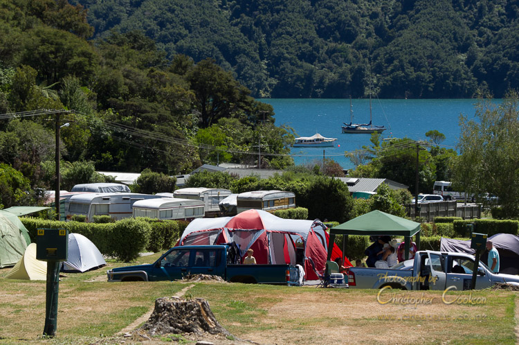
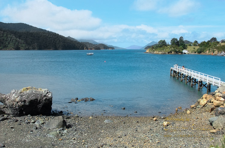
This is a fully serviced DOC campsite with hot showers, kitchen facilities, and even a shop where it’s possible to purchase a limited range of supplies including takeaways. Located along Queen Charlotte Drive, the campsite is located just across the road from the beach. The beach is a bit silty, but the western end is more suitable for swimming. There’s a bush walk up the back of the campsite, the Link Pathway between Havelock and Picton can be accessed, and the bay is ideal for kayaking. It’s a fairly short drive form Momorangi Bay to Anakiwa, one end of the Queen Charlotte Track. Both powered and unpowered sites are available, however due to popularity, bookings are required.
Aussie Bay
© Christopher Cookson License this image
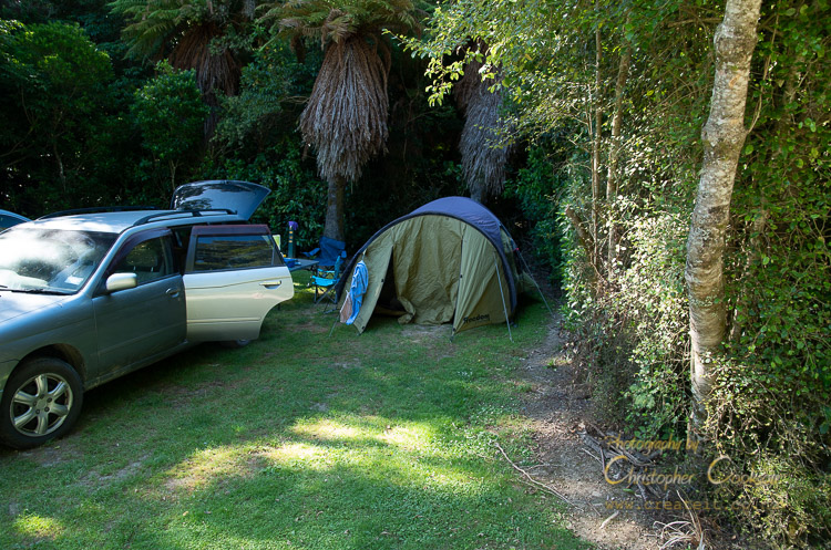
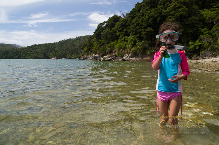
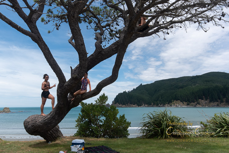
Aussie Bay is a basic DOC campsite towards the western end of Grove Arm in Tōtaranui / Queen Charlotte Sound. It has tent sites, a toilet, and tap water, but no other facilities. The beach is sandy, and suitable for swimming. About a kilometre to the west than Momorangi Bay, Aussie Bay is ideal for those who are prepared to be more self-sufficient in return for lower cost camping, and fewer other campers.
Moetapu Bay
© Christopher Cookson License this image
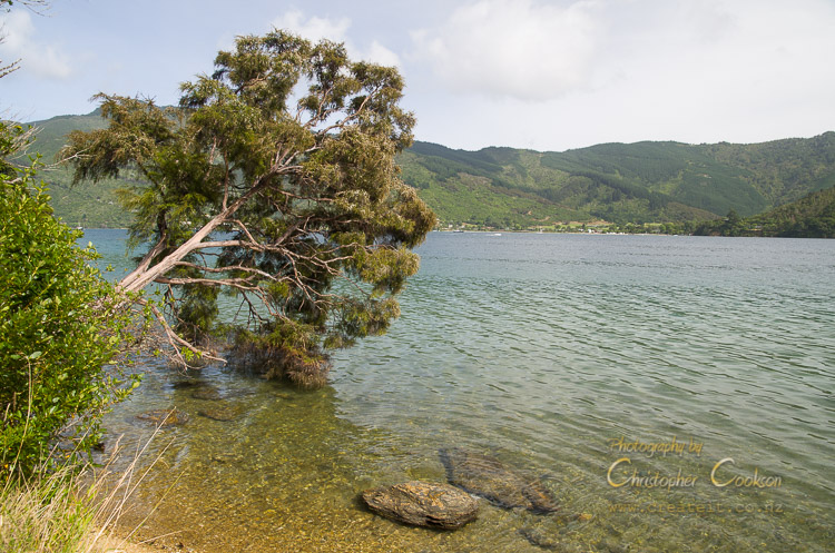
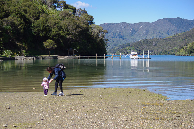
Moetapu Bay campsite is a basic campsite on a flat area of ground with room for just a handful of tents. There’s a short, steep track down to the beach from the ‘car park’, which is basically wherever you can find a spot along the roadside where parking is permitted without falling down the bank. There is a long gravel and sandy beach to the north, and another somewhat silty beach to the west, with the campsite in between. The spot is suitable for swimming, fishing, and walking along the beach, however there are no walking tracks in the vicinity.
Cowshed Bay
© Christopher Cookson License this image
Cowshed Bay campsite is a small campsite in Keneperu Sound just off the Queen Charlotte Track. This campsite has toilets, running water, cold showers, and a cooking shelter, and unpowered sites. It’s an ideal location for those walking or mountain biking the Queen Charlotte Track, and is less than a kilometre from Portage hotel, so it’s possible to camp out and enjoy a restaurant meal if you feel so inclined.
Mistletoe Bay
© Christopher Cookson License this image
Mistletoe Bay campsite is run by a private trust, and provides unpowered sites surrounded by native bush. Full kitchen facilities, toilets and hot showers are provided. Access is via Keneperu Road or boat from Queen Charlotte Sound. A shop on site provides some supplies, and kayaks are available for hire. The beach is quite silty, however swimming off the jetty is possible for clearer water.
Keneperu Head
© Christopher Cookson License this image
Keneperu Head campsite at the head of Keneperu Sound provides a good base to explore the outer Sounds including parts of Queen Charlotte Track and the highest peak in the Marlborough Sounds, Mount Stokes. Facilities are basic with a cooking shelter, cold showers, toilets and running water, with non-powered sites only, however bookings are required with DOC.
Harvey Bay
© Christopher Cookson License this image
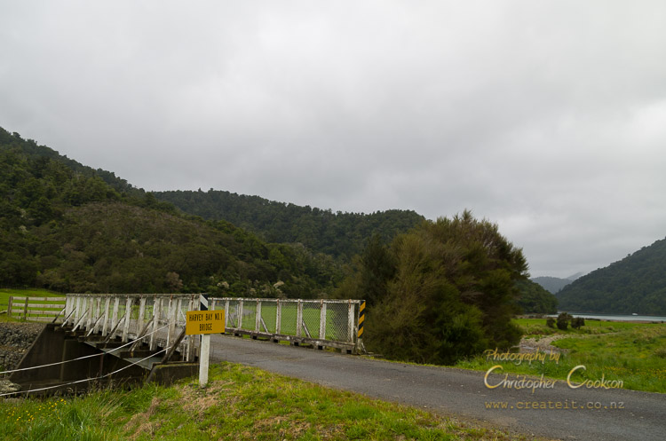
Harvey Bay campsite is a basic campsite in the remote and pristine Tennyson Inlet in the outer Sounds. The campsite has a toilet and unpowered sites. Access is via the Opouri Road which connects to the Ronga Road which in turn connects to State Highway Six just north of Rai Valley. Tennyson Inlet has a lot of pristine native bush, although the beaches are stony. There are several bush walks and mountain biking trails in the area, and the area is ideal to explore by kayak.
Elaine Bay
© Christopher Cookson License this image
Elaine Bay campsite is a basic non-powered campsite in the outer Sounds accessible from the French Pass road. It is near the northern end of the Archers walking track through to Tennyson Inlet through native bush, and is also about half way along the Croiselles French Pass Road, making it an ideal base to explore the outer Sounds.
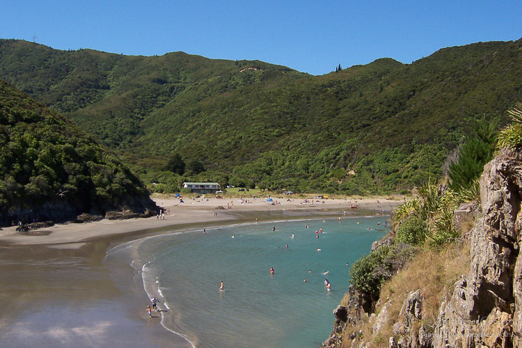
Robin Hood Bay
© Christopher Cookson License this image
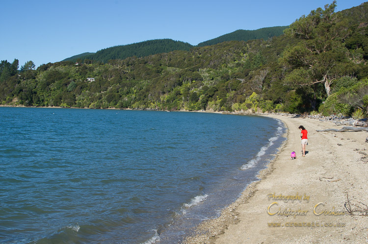
Robin Hood Bay is a popular surf beach accessible from the Port Underwood Road north of Blenheim, and has a basic DOC campsite with a toilet and running water. The northern end of the beach is sandy and suitable for swimming, and fishing from the beach is also possible.
Currently this campsite is free.
Pelorus Bridge
© Christopher Cookson License this image
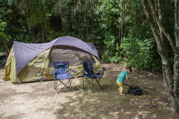
Pelorus Bridge Campsite is a large full service DOC campsite with hot showers and kitchen facilities, surrounded by native bush in the Pelorus Bridge Reserve, about half way between Blenheim and Nelson. Payment and check-in is made at the Pelorus Bridge cafe which sells hot and cold food and some merchandise. There are a number of bush walks in the area, and the Pelorus River is popular for swimming in summer, although the water is typically cold and deep, so best suited for confident swimmers.
Butchers Flat
© Christopher Cookson License this image
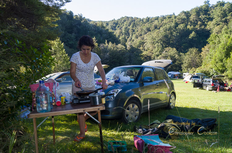
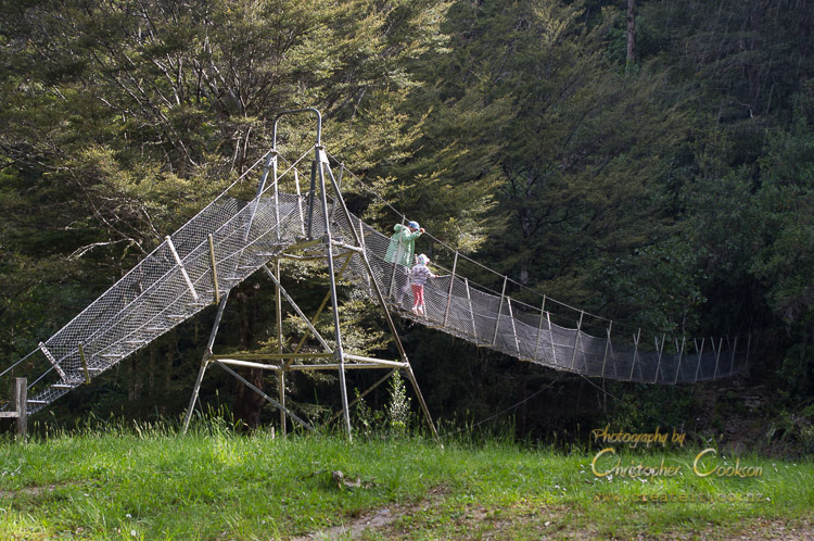
Butchers Flat is a large grassy area at the end of the road in the Wakamarina Valley. This basic DOC campsite includes tent sites and a ‘long drop’ toilet. Access to the river is possible, and the site provides access to Mount Richmond Forest Park via the Wakamarina Valley along an easy walking track that is also suitable for mountain bikes for the first part of the track at least.
This campsite has a modest fee.
Wairau
Mill Flat
© Christopher Cookson License this image
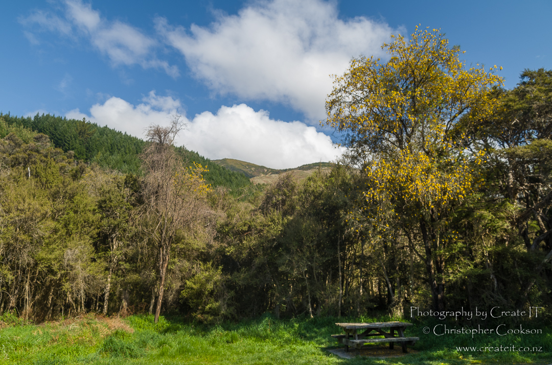
Mill flat is a grassy area surrounded by native bush beside Pine Valley Stream accessible by four wheel drive or on foot in Mount Richmond Forest Park. The area has basic unpowered sites, a toilet, and water, although you should be prepared to boil this for drinking. This is one of a handful of DOC sites that is free.
Kowhai Point
© Christopher Cookson License this image
Kowhai point is a small DOC reserve with native bush on the bank of the Wairau River in the Wairau Valley alongside State Highway 63. Toilets and running water (which should be boiled for drinking) are provided along with several unpowered sites amongst the trees.
Coldwater Creek
© Christopher Cookson License this image
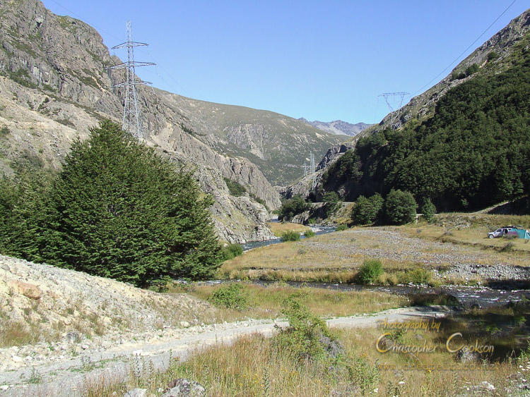
Coldwater Creek is a basic campsite in the Wairau Gorge on the Rainbow Road, only accessible in summer. The only facility provided is a ‘long drop’ toilet, and the area is extremely isolated, with vehicle access requiring a four wheel drive. A road toll is payable to Rainbow Station if travelling south, however if travelling north from Lake Tennyson, it is possible to reach Coldwater Creek without paying a toll. There is no fee to stay at this campsite.
Onamalutu
© Christopher Cookson License this image
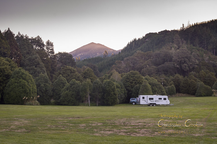
Onamalutu campsite is a DOC campsite set in a large grassy area surrounded by native forest. Most of the sites are unpowered, however there are a handful of powered sites. Facilities includ flush toilets and tap water. Access is via the Northbank Road off State Highway Six just north of the Kaituna bridge over the Wairau. After following the Northbank Road for several kilometres, then take Onamalutu Road.
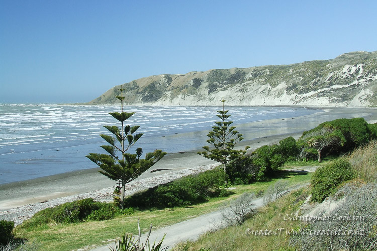
Rarangi
© Christopher Cookson License this image
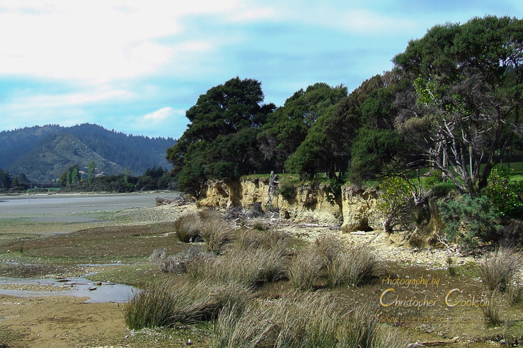
Rarangi is a DOC campsite at the northern limit of the Wairau Plain beside the beach settlement of Rarangi. Facilities incude flush toilet, cold showers, tap water, and unpowered sites. Rarangi beach is not generally regarded as a swimming beach, however it is popular for walking, and the nearby track to Whites Bay passes through native bush. There’s also a golf club within walking distance.
Whites Bay
© Christopher Cookson License this image
Whites Bay campsite has extensive sites set in native bush close to Blenheim’s most popular sandy swimming beach. Bush walks, swimming, beach games and day tramps (hikes) offer a range of opportunities, and being less than half an hour from Blenheim, if you forget anything, it’s not hard to fetch supplies. Facilities include cold showers, flush toilets, and tap water, but all sites are unpowered. Whites Bay is only a few kilometres from Rarangi, and there is a walking track between them through native bush, so if one campsite is full on arrival, it’s easy to try the other one.
Sites are all unpowered, and there is a fee.
Awatere
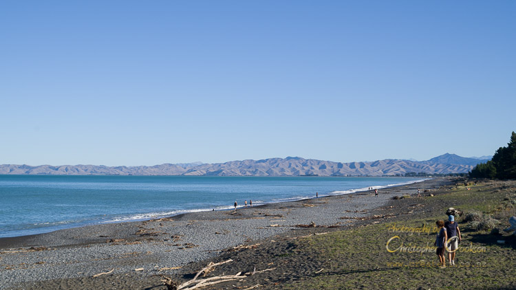
Marfells Beach
© Christopher Cookson License this image
Marfells Beach campsite is a popular campsite at Marfells Beach in Clifford Bay. Marfells Beach Road joins State Highway One just south of Lake Grassmere solar salt evaporation ponds. The campsite has a large number of unpowered sites, and has cold showers and flush toilets. The beach tends to be quite windswept and is not ideal for swimming, however it is possible to walk along the beach to Mussel Point or even Cape Campbell, and a wide variety of shells can be found on the beach. A variety of shore birds can be seen in the area including endangered banded dotterels that nest on parts of the beach.
Molesworth
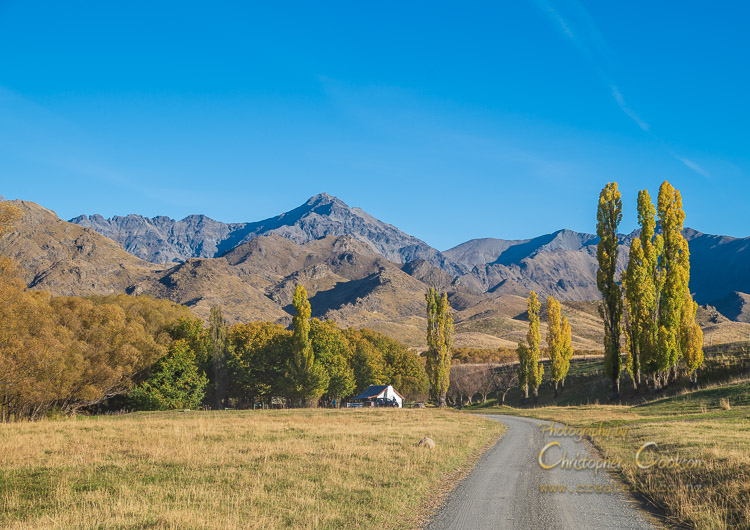
Cob Cottage campsite
© Christopher Cookson License this image
Molesworth is New Zealand’s largest farm and also a significant conservation area. The Molesworth cob cottage campsite in the upper Awatere Valley offers basic facilities with unpowered sites, a toilet, and running water. Due to an altitude of nearly 900m, nights can be cold even in summer, so appropriate bedding should be carried. The campsite is about 115km from Blenheim (via Taylor Pass), or slightly further via State Highway One. Molesworth is one of New Zealand’s largest wilderness areas, and has various opportunities for tramping (hiking), mountain biking and four wheel driving.
Web Links
Cite this page
Cookson, C. (2020). Camping in Marlborough. Retrieved April, 27, 2024, from https://www.marlboroughonline.co.nz/marlborough/information/recreation/camping-in-marlborough/