Pelorus Bridge Scenic Reserver Walking/hiking Tracks
Last Modified: 18-2-2019 1:04
By: Christopher Cookson
© Christopher Cookson License this image
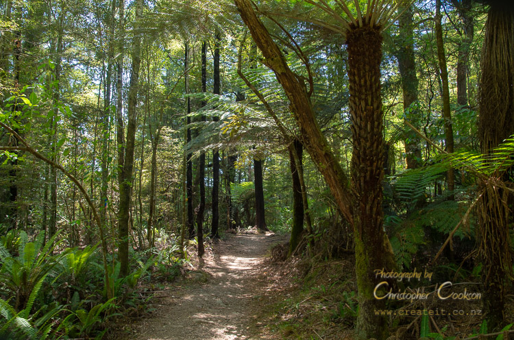
Pelorus Bridge Scenic Reserve has a number of short walking (hiking) tracks through a preserved remnant of native bush. Some of the tracks within the reserve connect to the Te Araroa Trail, a 3000km route that stretches the length of New Zealand from north to south.
On the west side of the State Highway 6, from the cafe car park, the Tawa Walk provides a short, easy loop through native bush with interpretive panels, that can be completed in under half an hour. For those with more time, this track connects to the Elvy Waterfalls track which leads to two small waterfalls with views over the Pelorus River in places. Parts of this track are narrow, and there are areas where it is necessary to descend short steep sections of track through tree roots. The track is easy enough for most adults, but may not be suitable for very young children, or for anyone without a good sense of balance. The track returns by the same route, with an estimated walking time by DOC of two hours return. After the second waterfall, it is possible to continue in a loop that climbs to Trig K at 417m. This is the steepest track in the area, with a climb of over 350m, with an estimated time to complete the entire loop back to the carpark of four hours. For those who complete this climb, the reward is excellent views of the surrounding landscape. For comparison, this involves a similar altitude, but in about half the distance to Mount Vernon on the Wither Hills in Blenheim, which many people walk every day.
On the east side of State Highway 6, there are two tracks; the short Tōtara walk loop, and the longer Circle Loop Track. The Tōtara walk passes through native forest to Tōtara Flat, while remaining on the true right of the river at all times. Walking time is estimated at 30 minutes. The Circle Loop Track requires crossing the Pelorus River via the historic Pelorus Bridge via a pedestrian path, and then shortly after crossing the river follows the true left of the Pelorus River through an easy, flat path to a swing bridge over the Rai River. Beyond the swing bridge, the track forms a loop through native bush, with steps in places, and the track generally narrower, and a little less well formed. The estimated walking time for the entire loop is 45 minutes. The Circle Loop Track connects with Dalton's Track, which follows the Pelorus (Te Hoire) River as part of Te Awaroa Trail.
Sandflies are common, so insect repellent is necessary, and wasps are present in some places in spite of control measures, so it may be worthwhile to carry antihistamine.Although the tracks are not long, there are no streams with safe drinking water, and even in the forest, conditions can get very warm in summer, so you should carry drinking water if you intend to do any of the walks that are longer than half an hour.
In heavy rain, the Pelorus River can flood parts of some tracks, so if at all uncertain, check with DOC before proceeding.
Web Links
Cite this page
Cookson, C. (2019). Pelorus Bridge Scenic Reserver Walking/hiking Tracks. Retrieved April, 27, 2024, from https://www.marlboroughonline.co.nz/marlborough/information/recreation/tramping-and-walking/pelorus-bridge-walking-tracks/