Kaituna River
Last Modified: 16-2-2020 21:40
By: Christopher Cookson
© Christopher Cookson License this image
The Kaituna River is a small river about 20 kilometres long in northern Marlborough with its source in the Richmond Range near Mount Riley, and it's mouth in Pelorus Sound at Havelock. Between 70-130 thousand years ago, the Kaituna River was part of the Pelorus River, and flowed south into the Wairau River, however a build up of sediment at the south end of the Pelorus/Kaituna Valley, rising sea levels following the last ice age, and sinking and tilting of the Marlborough Sounds led to a reversal of flow so that today, the Pelorus and Kaituna are separate rivers. The geology of the Kaituna Valley is influenced by its past with much of the sediment in the valley known as Pelorus Gravels from the past as the lower reaches of the Pelorus River. These gravels overlay schist bedrock, and themselves are overlaid by fine marine clay sediments and finally a layer of yellow clay estimated to have been deposited around 7,000 years ago by the current Kaituna River.
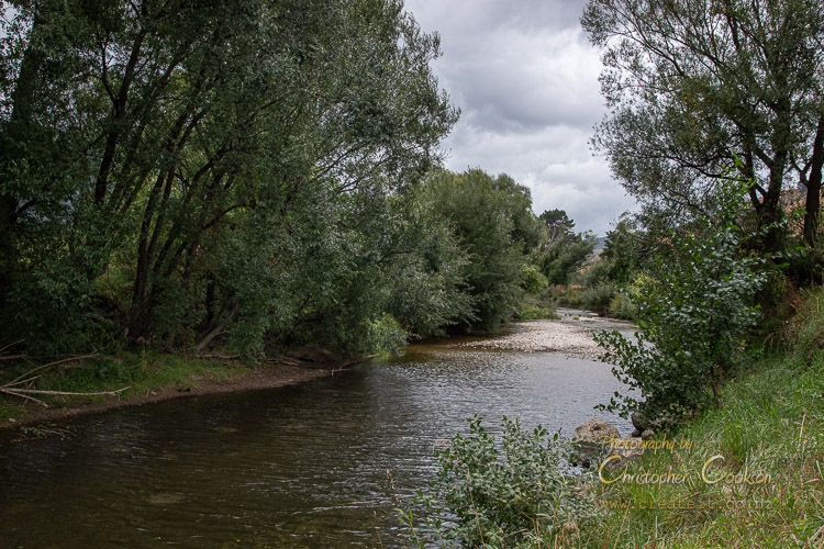
For the majority of its course, the Kaituna flows through pastoral farmland, with occasional patches of mānuka scrub. Willows are common alongside the river. The river forms a single channel. According to Marlborough District Council data, a 'three year flood event' is flow levels above 130 cumecs. In a severe flooding event, the river may close State Highway 6. In summer, flow can drop to below 0.5 cumecs. Rainfall in the catchment area varies from about 1200mm per year to 1600mm per year depending on location. The Kaituna has several small streams as tributaries, including the Okaramio River.
In a 2014 survey of the natural character of 39 Marlborough rivers commissioned by Marlborough District Council, the Kaituna had a fairly average rating, with relatively low water quality, and extensively modified surrounding landscape preventing a better score.
Groundwater from the river's aquifer is used to supplement Havelock's water supply.
Presumably the river gets its name from being a plentiful source of eels for Māori, as kai is food, and tuna eel in Māori.
The Kaituna River is bridged several times on Mount Riley Road, and State Highway Six between Blenheim and Nelson crosses the river near Prices Road. A bridge also crosses the river on Queen Charlotte Drive near the mouth of the river.
Web Links
Cite this page
Cookson, C. (2020). Kaituna River. Retrieved April, 27, 2024, from https://www.marlboroughonline.co.nz/marlborough/information/geography/rivers/kaituna-river/