Acheron River
Last Modified: 20-3-2021 23:15
© Christopher Cookson License this image
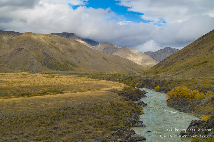
The Acheron River is a remote Marlborough river that flows south about 60km from its headwaters near the Acheron Saddle through Molesworth to its confluence with the Clarence. Rainfall in the catchment area of around 1000 square kilometres is low, with 800mm or less on average per year, however with a normal flow with a range between 10-20cu m/s (source: NIWA) with a mean flow of 23.4cu m/s to 2005 at its confluence with the Clarence, the river is of similar size to the Awatere. Tributaries include the Saxton, Alma, and Guide rivers.
Prior to European settlement, Māori used trails that followed the river, and later European settlers followed the river as a route between Nelson and Canterbury. Due to its entire course being within the Molesworth area, with only seasonal road access, the river is less well known than the other major Marlborough rivers. Two suspension bridges cross the river including the historic Lower Acheron Suspension Bridge, built in 1945 by students from Canterbury University. Near the confluence with the Waiau Toa / Clarence, the historic Acheron guest house remains as a legacy to when the Acheron valley was a major route.
Parts of the catchment are grazed wtih beef cattle by Pāmu (Landcorp Farming Limited), a state owned enterprise as part of the management of Molesworth Station.
The river has small numbers of brown trout which may reach substantial size. Chinook salmon spawn in the upper reaches of the river.
Cite this page
Acheron River. (2021) Retrieved April, 27, 2024, from https://www.marlboroughonline.co.nz/marlborough/information/geography/rivers/acheron-river/