Ward
Last Modified: 19-2-2019 10:15
© Christopher Cookson License this image
Ward is a small settlement in the south of Marlborough. Named after Sir Joseph Ward, a former Prime Minister of New Zealand at the beginning of the Twentieth Century, the settlement is situated in the Flaxbourne district, once a large pastoral farm, later split up by the government. Under current district boundaries Ward is the southernmost township in Marlborough.
The town has two small churches, a school, a service station including a cafe, and several other small businesses. Some areas of land around Ward have been converted to viticulture, however a significant amount of pastoral farming is still present. As at the 2013 Census, the area designated 'Ward' had a population of 930 according to the official census data, however this includes the Awatere Valley and areas around Seddon. The meshblocks including the Ward settlement and surrounding areas actually indicate a population of around 200.
The area has low rainfall and relatively high winds, which have been exploited with the installation of a number of wind turbines in the area.
The town holds an annual A&P show in March.
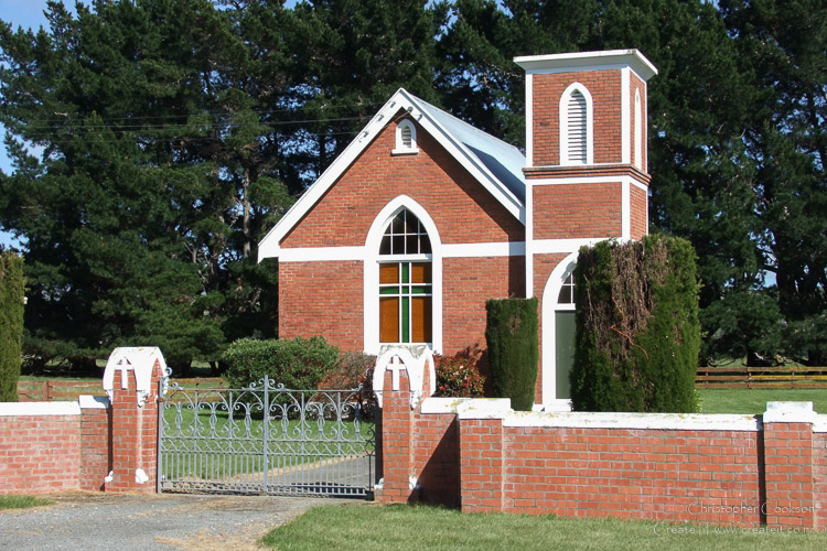
A strong earthquake in Cook Strait of magnitude 6.5 on Sundady 21 July 2013 was followed by a magnitude 6.6 earthquake on Friday, August 16 2013 centred under Lake Grassmere, causing severe damage to a number of buildings around Ward. St Peter Chanel Catholic church (pictured before the earthquake) is one of the structures to be demolished as a result of the earthquake.
Web Links
Cite this page
Ward. (2019) Retrieved April, 27, 2024, from https://www.marlboroughonline.co.nz/marlborough/information/geography/towns-settlements/ward/