Waikakaho/Cullen Creek Walkway
Last Modified: 16-2-2021 16:52
By: Christopher Cookson
© Christopher Cookson License this image
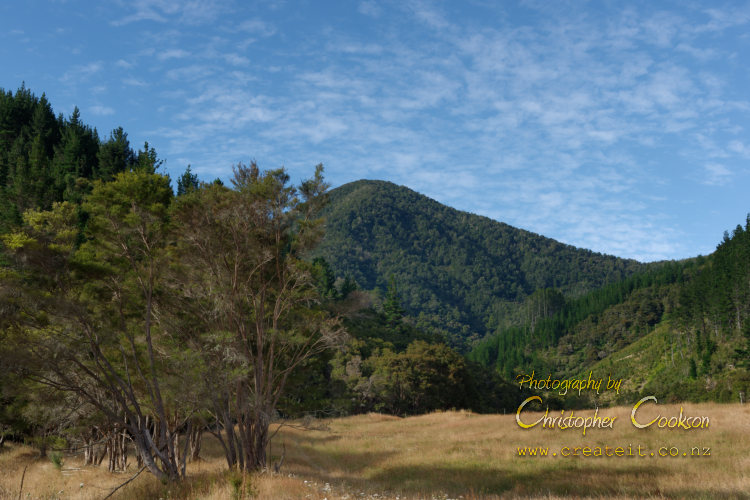
The Waikakaho / Cullen Creek Walkway is a Marlborough tramping track that follows and old goldminers’ trail from the head of the Waikakaho Valley to Linkwater. From the head of the Waikakaho Valley, the track climbs steeply from 100m, through regenerating native bush to just over 900m altitude at the highest point at the Waikakaho Saddle. From the saddle, the track drops down to follow Cullen Creek through an area of pine forestry till it reaches the Cullensville Road in Linkwater. Along the track various relics of the mining era can be seen, including some old mine shafts which are dangerous and should be avoided. The track is a bit over seven kilometres long, with DOC estimating a walking time to complete the full track of five hours in one direction, although many people will be able to walk the track in a shorter period of time. Mountain biking is also permitted on the track, with a grade four rating. DOC estimates 2.5 hours from the start of the track to the Waikakaho Saddle, which may be more suitable as a day walk, since a walk through to Linkwater will require transport arrangements to return walkers back to Blenheim. For those wanting to walk the full track, a good arrangement is to have two vehicles and have one party start from each end, exchanging keys when they meet on the track, so each group have transport home.
Getting There
The easiest way to get to the track is to travel north from Blenheim to Tuamarina, then turn off State Highway One onto Bush Road which leads onto the Kaituna Tuamarina Road also known as the Tuamarina Track. About six kilometres west from State Highway One, there is an intersection with the Waikakaho Road. Follow this road to the end, about ten kilometres from the intersection. The last two kilometres of road pass through private property, with gates that need to be left as found. This last section of road may be unsuitable for two wheel drive vehicles after rain, so assess the condition before proceeding with your vehicle, as there is no cell phone reception if you get stuck.
If you intend to walk the track from the Linkwater end, drive from Blenheim to Havelock, and turn onto Queen Charlotte Drive, then just before Linkwater turn onto Cullensville Road.
Things to be know
The northern section of the track passes through an area of plantation forestry which may be closed due to forestry operations. If in doubt, check DOC’s website for any alerts relating to this track.
There are stream crossings which may be dangerous after heavy rain.
Things to See
There are numerous relics of the gold mining era along the track, and there are a wide variety of native plants, fungi, and bird species that you may encounter.
Web Links
Cite this page
Cookson, C. (2021). Waikakaho/Cullen Creek Walkway. Retrieved April, 24, 2024, from https://www.marlboroughonline.co.nz/marlborough/information/recreation/tramping-and-walking/waikakaho-cullen-creek-walkway/