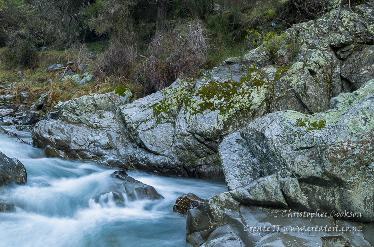
Avon River, Marlborough
Last Modified: 1-3-2020 22:11
© Christopher Cookson License this image
The Avon River is a tributary of the Waihopai River in Marlborough, draining a catchment of 190 km2 with its headwaters near the Avon Saddle. The river is approximately 22km long from its source to its confluence with the Waihopai River, flowing through a well defined valley formed predominantly of sandstone bedrock. Median flow near the confluence with the Waihopai is 2.02 cumecs. Much of the lower catchment is moderately hilly agricultural land, while in the upper catchment there are areas of plantation pines and native kānuka and mānuka scrub on steep terrain with peaks that rise to over 1000m. Much of the area was burnt with the arrival of humans, however small pockets of red and black beech remain in some valleys, and remnants of kahikatea and titoki can also be found. Parts of the catchment near the source of the Avon fall within the Glazebrook Conservation Area, however access is across private land.
Longfin eel, upland bully, brown trout, northern flathead galaxias, are among the vertebrate species found in the Avon. Invertebrates include freshwater crayfish, mayflies, sandflies, caddisflies, craneflies and oligochaete worms.
Tributaries of the Avon include the Tummil and Teme Rivers.
Several bridges cross the Avon on the Avon Valley, and Summerlands Roads.
References
NIWA FBIS Freshwater Biodiversity
Booker, D.J., Whitehead, A.L. (2017). NZ River Maps: An interactive online tool for mapping predicted freshwater variables across New Zealand. NIWA, Christchurch.https://shiny.niwa.co.nz/nzrivermaps/
Web Links
Cite this page
Avon River, Marlborough. (2020) Retrieved April, 20, 2024, from https://www.marlboroughonline.co.nz/marlborough/information/geography/rivers/avon-river/