Black Birch Range
Last Modified: 1-9-2021 10:11
By: Christopher Cookson
© Christopher Cookson License this image
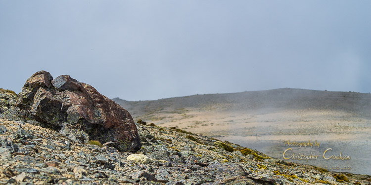
The Black Birch Range is one of several named mountain ranges that bound the Awatere Valley to the north. The range runs north east from Altimarloch, the highest point, at 1693m to Black Birch Stream. Parts of the lower slopes of the southern side of the range are planted in radiata pine, while the higher altitudes and northern parts of the range are part of the DOC estate as part of the Ferny Gair Conservation Area, with kānuka forest on the lower slopes following Black Birch Stream, along with some remnant beech forest, with alpine fell-fields including specialised plants such as 'vegetable sheep', and scree daisies along the flat ridge line. At intermediate altitudes above the bush line, alpine herb fields with tussock grasses Aciphylla species, hebes, and alpine daisies predominate. A variety of invertebrates can be found in the alpine habitat including alpine grasshoppers and black mountain ringlet butterflies.
During the 1970s, the United States Navy constructed an observatory on top of the range to map the southern sky. New Zealand's Carter Observatory also had a smaller observatory. In anticipation of establishing an observatory, Princeton University built a house on the top of the ridge in the 1960s, with the Botanical Society recording a field trip to Black Birch that stayed in the house over Easter 1967. When US Naval operations ceased in 1996, as part of the conditions of operation, all traces of the observatory were removed, and the environment was allowed to revert to its natural state. Although the observatories are gone, the four wheel drive access road remains, making the Black Birch Range one of a handful of alpine environments above 1000m accessible by vehicle in New Zealand. Although vehicle access is possible, the road is rough and rock strewn, and crosses private forestry land with a locked gate on Awatere Valley Road, so only limited access is possible, however this helps preserve the sensitive alpine environment.
A power cable runs to the flat summit of Altimarloch where a microwave communications tower and generator shed are situated. (Altimarloch was named by Scottish settlers after a location in Scotland where a battle was fought, translating as 'burn of the gravestones', possibly due to the rugged countryside with a number of tors near the summit.)
Pigs, goats, red deer, and chamois are present in the area, with hunting allowed with a permit from DOC.
Cite this page
Cookson, C. (2021). Black Birch Range. Retrieved April, 20, 2024, from https://www.marlboroughonline.co.nz/marlborough/information/geography/high-country/black-birch-range/