Flaxbourne - A Marlborough region with a big heart
By: Christopher Cookson
Last Modified: 9-8-2021 17:38
© Christopher Cookson License this image
Travelling south from Seddon, you enter the dry, rolling, windswept hill country of south Marlborough, a vast, sparsely populated area bounded by the Pacific Ocean to the east, Kaikōura District to the south, the Inland Kaikōura Range to the west, and the Awatere Valley to the north. Centred around Ward, the only settlement, the wider area is known as Flaxbourne, after the Flaxbourne Run, which was compulsorily acquired and subdivided by the government in the early 20th Century.
From State Highway One, the Flaxbourne district can seem to be fairly uninteresting, however this impression is somewhat deceptive.
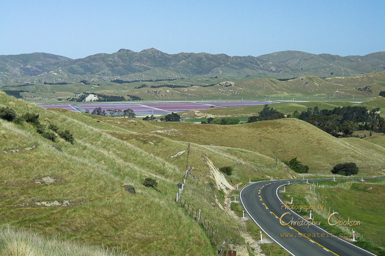
Vines, pasture, and hills
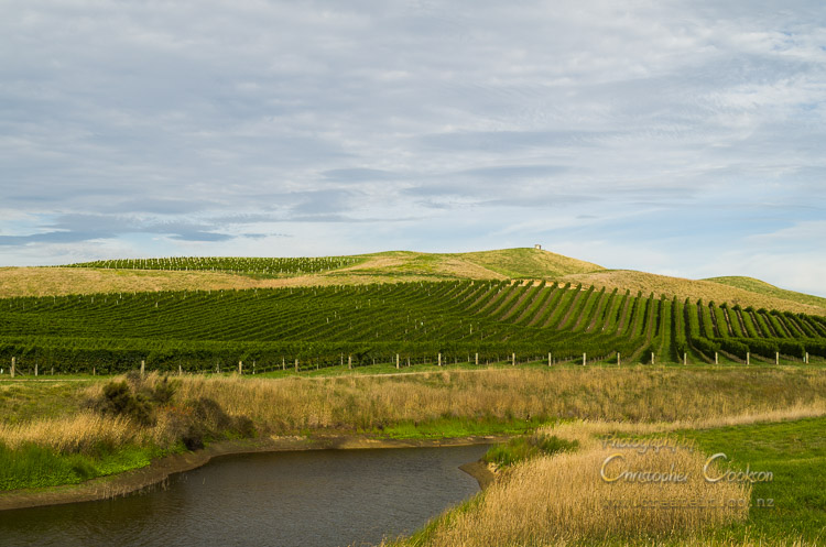
© Christopher Cookson License this image
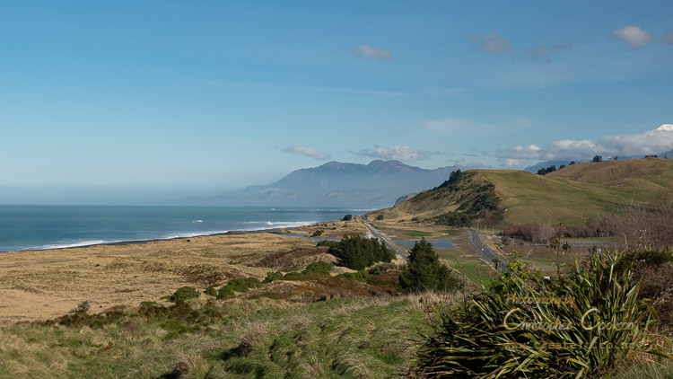
Most of the flatter land is occupied by vineyards, with numerous irrigation dams dotting the landscape, made necessary by the lack of natural water sources in the heat of summer, although the area is criss-crossed with many small ephemeral streams that can fill with water in winter. Where the land is too steep, too dry, or the soil is too poor for vineyards, pastoral farming is still common in this part of Marlborough, and out on the dry, windy coast near Cape Campbell, an extensive plantation of hardy nut pines covers hillsides, with the pine nuts contributing to a successful export industry. Fine merino is raised in the high country, and Taimate runs an Angus stud. At Weld Cone, and further south at Single Hill, wind turbines stand out against the skyline, taking advantage of the steady coastal breeze. Lake Grassmere is Marlborough’s only solar salt production facility, taking advantage of the low rainfall, high sunshine hours, and drying winds to produce salt via evaporation. The coastline varies between sandy beaches and rocky reefs with virtually no safe harbours or sites for launching boats, with the lighthouse at Cape Campbell marking one of the larger reefs.
My own association with the Flaxbourne District is a bit like the ephemeral streams of the area, it’s never permanent, but always recurring. One of my mother’s best friends married a farmer who lived up Needles Road, resulting in infrequent childhood visits, so I have fond memories of the musty smell of their wool shed, and shovelling sheep manure from underneath by the trailer load. I can also remember collecting field mushrooms and riding around the farm in the back of the ute, blissfully unaware of health and safety standards that now exist. I remember coming home with home made butter, churned as I watched, and numerous pine cone gathering expeditions.
Shaky landscape
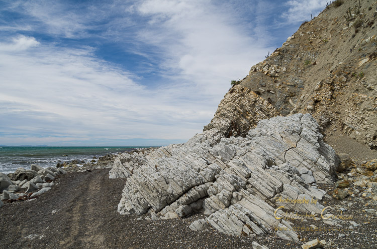
© Christopher Cookson License this image
The area is earthquake prone, suffering several large earthquakes in the 19th Century, and in the early 21st Century, and indeed Māori traditions tell the story of Kupe and Te Hau engaged in a dispute which led to Kupe conjuring up a great flood that formed what is now Kapara Te Hau or Lake Grassmere. While the tradition might be embellished to make a memorable story, it certainly fits with the geological activity of the area, which can be clearly seen in the twisted layers in rocks along the coast.
Marlborough's southern most expresso

© Christopher Cookson License this image
As an adult, when I’m heading south, I try to make a habit of stopping in at Flaxbourne Tearooms, to grab at least a coffee, and sometimes more. I’ve enjoyed some of the best carrot cake around at Flaxbourne Tearooms, although the place is unpretentious, and sells itself on good food, and good humour rather than rustic charm.
People in Flaxbourne have an intergenerational connection to the land, and many take great pride in that connection, and also have a strong sense of responsibility to care for and protect what they have. The same farm that I have fond childhood memories of continues on in the same family, passed on to the next generation, and I know others in the area who also keep family traditions alive.
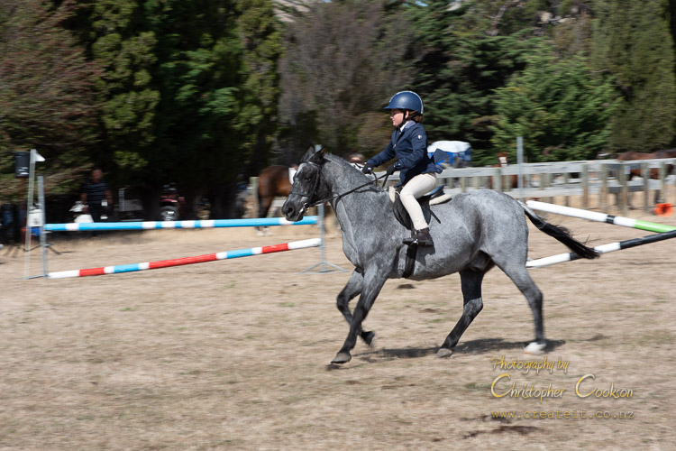
No town without an A&P Show
© Christopher Cookson License this image
Speaking of traditions, no rural community would be complete without their A&P show, and Flaxbourne is no different. For such a small community, it’s surprising how many people turn out and transform the usually empty show grounds into a busy throng of people, including the same tacky sideshows that seem to have been doing the rounds of every A&P show since I was a kid.
This is a fiercely independent rural community, and while there is plenty of local initiative to look after the land, I get the feeling that meddling local and national politicians wanting to impose their own rules aren’t always the most welcome, even though Ward is named after a former politician, however anyone who’s prepared to show up with a spade to lend a hand will likely be welcomed with open arms. Although there is plenty of local can-do attitude, it’s not without disputes. The East Coast Protection Group which has championed a vehicle ban along the beach from the Waima/Ure River to Cape Campbell, to protect the sensitive coastal habitat has met resistance from some locals, and some members of the wider Marlborough community, and there have been accusations against those both in favour of and against the ban. I’ve personally had contact in the past with the Peters, one of the families in favour of the vehicle ban, and I simply can’t see why they’d be accused of having ulterior motives for keeping vehicles off the beach. They’re nice people, and passionate about protecting their slice of paradise. Not only are they active in advocating for protecting natural heritage, but have also been actively involved in preserving local history. Following the 2016 Kaikōura earthquake, pedestrian beach access has become safer and more reliable due to coastal uplift, making timing to coincide with tides far less of an issue, but old habits die hard, although I think when I was a kid, quad ‘bikes’ were only just being introduced, so it’s probably a not particularly long tradition that’s being overturned. Ironically it may be the same local self-reliant attitude that has led one group of locals to advocate for protecting their beach that has led another group to feel that their independence is being infringed on.
Coastal Treasure
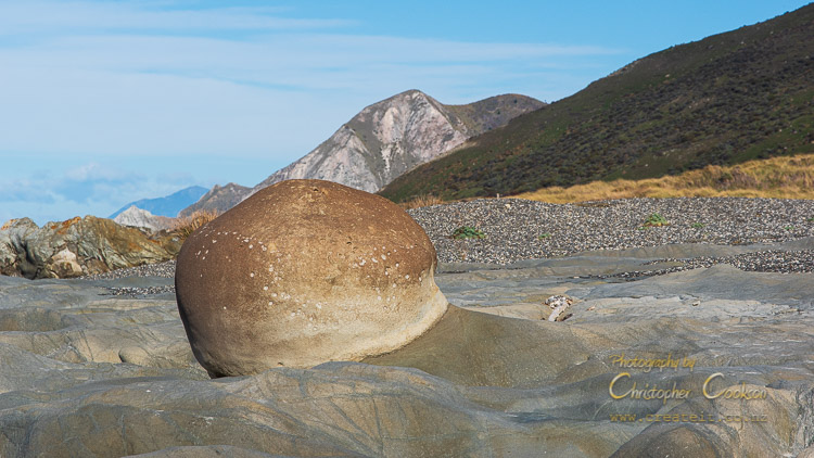
© Christopher Cookson License this image
Walking along the coastline either from Marfell’s Beach in the north, or Ward beach in the south, it’s definitely possible to appreciate the special nature of this part of coast. When I was a kid, banded dotterels used to be a common site on the braided riverbeds of North Canterbury, but predation and growth of invasive plants that have choked their river breeding grounds have led to them becoming an endangered species, but here along the coast, you’re almost certain to see these native birds, in this area they’ve retreated to where they still nest and raise chicks.
The geology exposed by the coastal uplift is fascinating, and although the Ward Beach concretions might not match the more famous Moeraki Boulders in size, they are still interesting.
What earthquakes give, they also take away. Isolation Creek, with its stunning Sawcut Gorge, a giant cleft in the rock that looks as though someone has sliced through the mountainside, been off limits for several years now. The Waima/Ure valley does have other unexpected treasures though, including the farmer who’s an enthusiastic musician and has built up a home sound studio.
A Farmer, a Lake, and a Conservation Plan
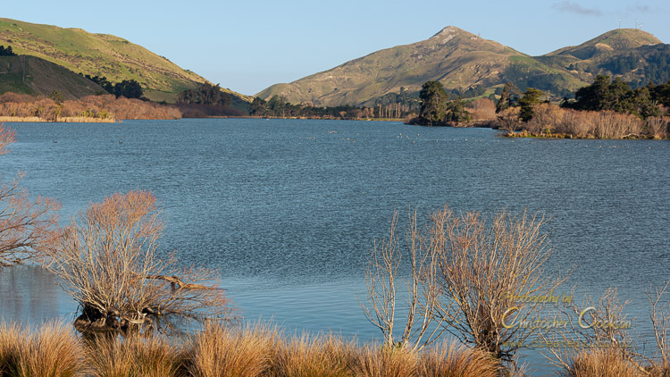
© Christopher Cookson License this image
Lake Elterwater, to the east of State Highway One is one of Marlborough’s few freshwater lakes, and by far the most accessible one, but for many years was a mess of invasive willows. Thanks to a successful poisoning campaign, most of the willows are gone, and a planting initiative led by local farmer, John Hickman, has begun the process of re-vegetation the lake shores in native species. John comes across as very much a kiwi farmer, passionate about his farm, but also keen to ensure the lake is an asset that can be appreciated by all. John has organised several planting days with volunteers to progressively replant the lake shores in native plants.
It seems like Flaxbourne breeds farmers with a sense of responsibility. Doug Avery has become something of a national celebrity after facing financial and emotional ruin, through droughts and earthquakes, however instead of giving in, turned his life and farm around, wrote a book, and now works to help farmers across New Zealand achieve financial, social, and environmental sustainability.
Physical and emotional well being aren’t the only things that come out of the small community. Miriam Taylor is a ‘retired’ Anglican Priest married to another local farmer who served the spiritual needs of the community for fourteen years, before officially retiring. I’ve personally had the privilege of hearing Miriam preach on a number of occasions, and I’ve always respected her wise words.
A Broken Church
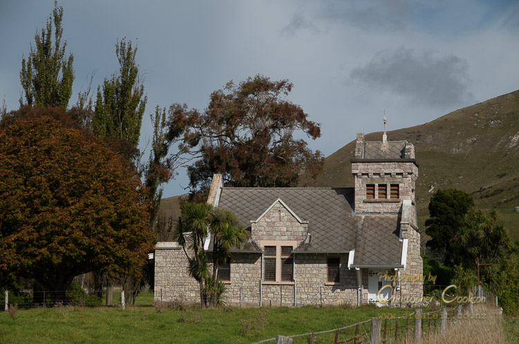
© Christopher Cookson License this image
Other signs of community resolve in the wider area include the community effort to save St. Oswalds, the southernmost church in Marlborough District, situated on the east of State Highway One at Wharanui near the southern boundary of the current district boundary, and badly damaged in the Kaikōura earthquake. Although the Nelson Anglican Diocese could not afford to restore the church, a community effort to save and restore the church have been fundraising to ensure the iconic building is not lost. Just a couple of kilometres to the south, Marlborough District ends along a fairly nondescript section of highway north of Tirohanga Stream.
© Christopher Cookson License this image
Web Links
Cite this page
Cookson, C. (2021). Flaxbourne - A Marlborough region with a big heart. Retrieved April, 24, 2024, from https://www.marlboroughonline.co.nz/marlborough/information/commentary/flaxbourne-a-marlborough-region-with-a-big-heart/
Be part of the conversation
Sign up to post comments.